Comments
- No comments found
The applications for artificial intelligence (AI) technology are rapidly growing with each passing year.
From construction to healthcare, it’s changing how every industry operates. Of course, one sector it is significantly impacting is the science industry — particularly in AI remote sensing.
Artificial intelligence programmes and machine learning technology are making remote sensing easier, faster, and more efficient than ever. Here are a few ways AI is changing remote sensing.
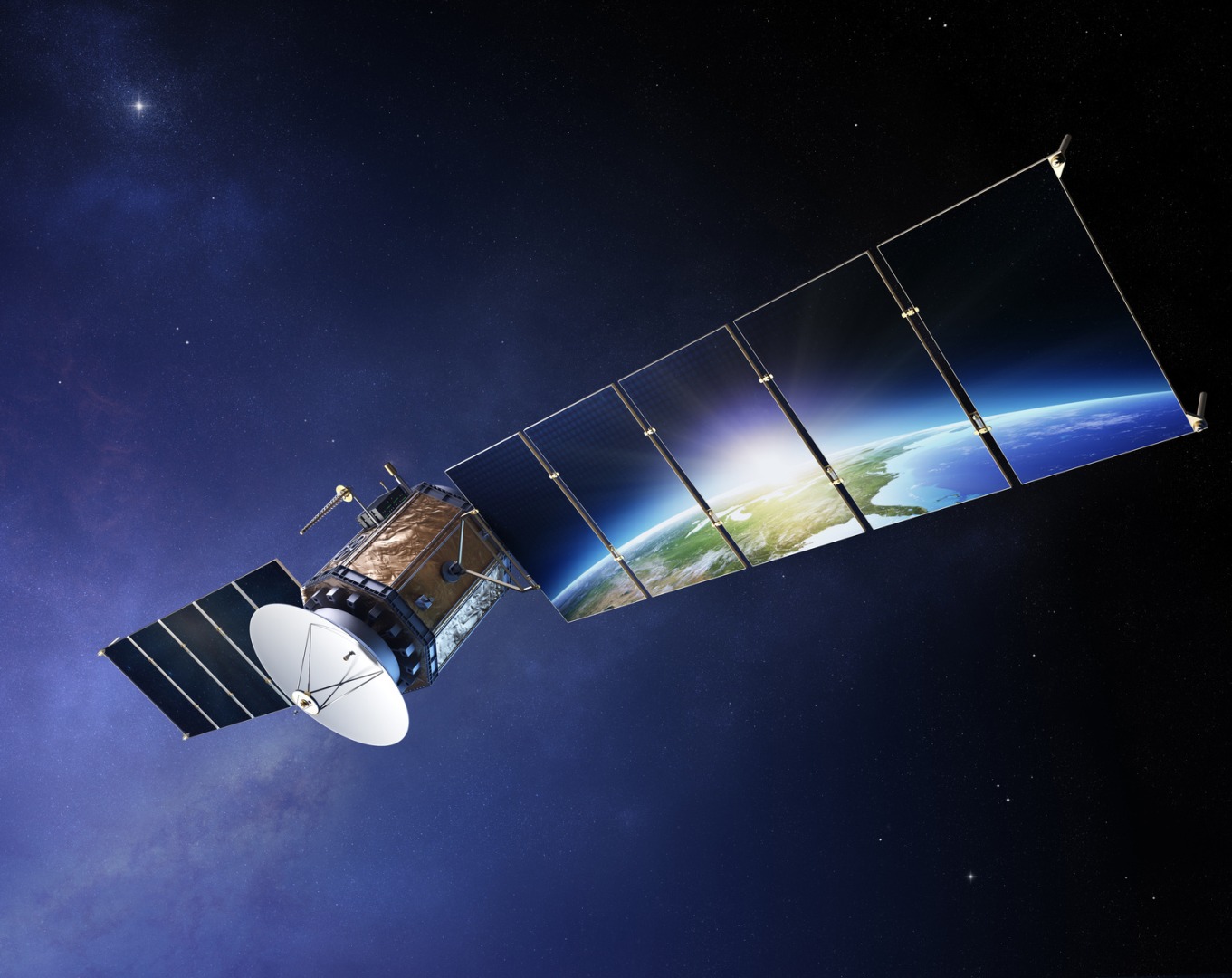
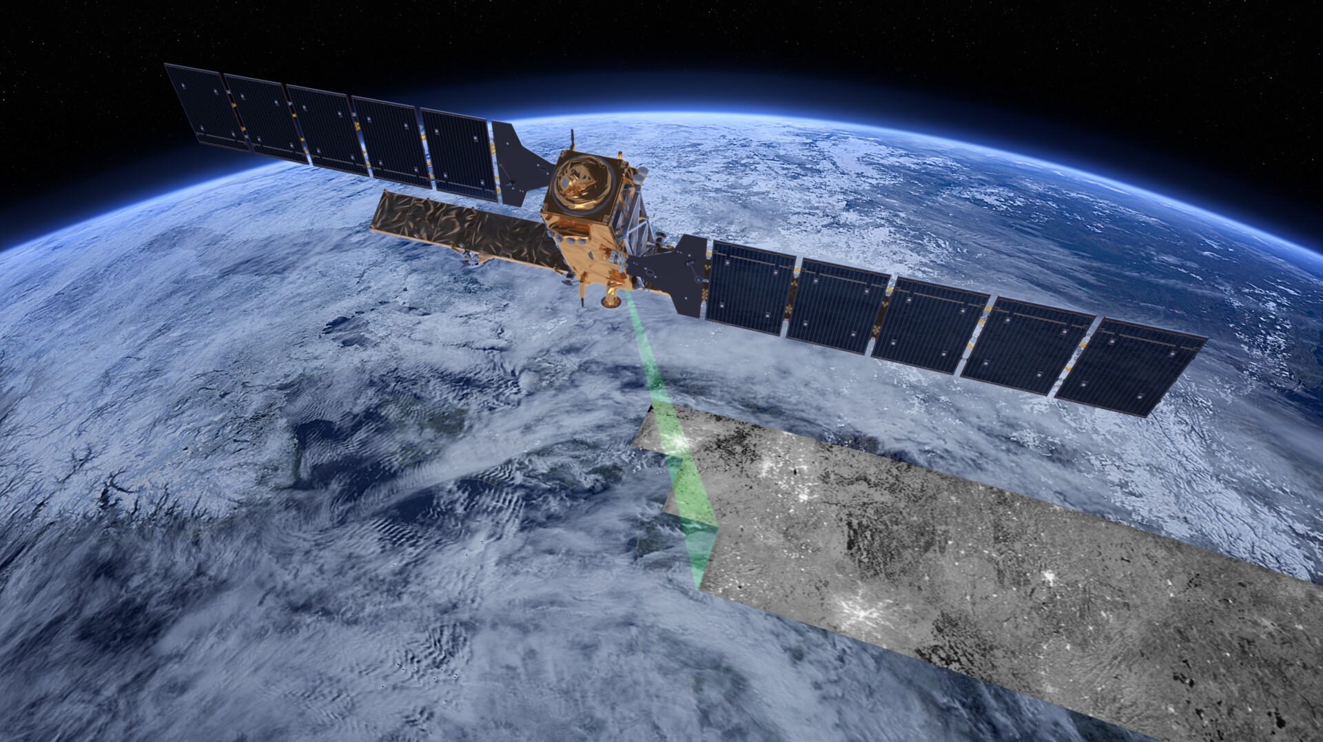
Remote sensing is a method of detecting light radiation wavelengths. Different objects emit or reflect this type of radiation, which remote sensing devices can identify. These tools can process an extensive array of wavelengths and spatial orientations. Being able to observe objects in this way gives scientists an insight greater than if they just looked at it.
Astronomers most commonly use remote sensing to study the movements of the stars and other celestial objects. Meteorologists also use it to track weather patterns to make forecasts. Remote sensing technology can also be used in other fields, such as archeology, agriculture and urban development.
One of the greatest strengths of artificial intelligence is its ability to process large amounts of data quickly and efficiently. In astronomy and meteorology, this can help scientists working with remote sensing tools enormously.
Instruments such as satellites and telescopes can gather a wealth of data in a short period. They observe and record everything from the movements of celestial objects to Earth’s natural processes.
Managing the titanic amount of information using conventional tools can be challenging. AI algorithms can make analysing that data a much easier task. These programmes can automate information processing, sorting through large amounts of data and creating reports based on the parameters it was programmed to follow.
Handing off much of the processing to AI can free scientists to use their time for more critical aspects of their projects. This means they can get more work done in less time. Scientists no longer have to sift through all the information gathered by remote sensing instruments. This can allow them to look over only the most relevant data — the pieces that can contribute to their research.
In addition to making data processing more efficient and manageable, AI remote sensing tools can also make information gathering more accurate. In the field of scientific research, the accuracy of data is paramount.
AI algorithms can analyse data remote sensing instruments gather. These can be programmed with specific parameters to seek out only the most relevant data for a project.
Furthermore, AI can also help interpret data to determine whether or not it is helpful to the study.
This means data from remote sensing instruments can give researchers more actionable results. In addition, the increased accuracy of remote sensing data can be a boon to other types of projects and research — such as meteorology.
One of the most significant problems when predicting weather patterns is the accuracy of predictions diminishes as it goes further into the future. However, advances in remote sensing and AI technologies have made predicting the weather more accurate than ever before.
AI can use the imaging data remote sensing instruments gather to predict how weather formations will look in the near future. These predictions can be much more accurate because AI can focus on only the most relevant data to make calculations, reducing the possibility of error.
These technologies can also apply to other fields, such as agriculture. Remote sensing is often used to monitor crop growth so farmers will better understand how to manage them. Therefore, the accuracy of the data from remote sensing equipment can be paramount to a farm’s success.
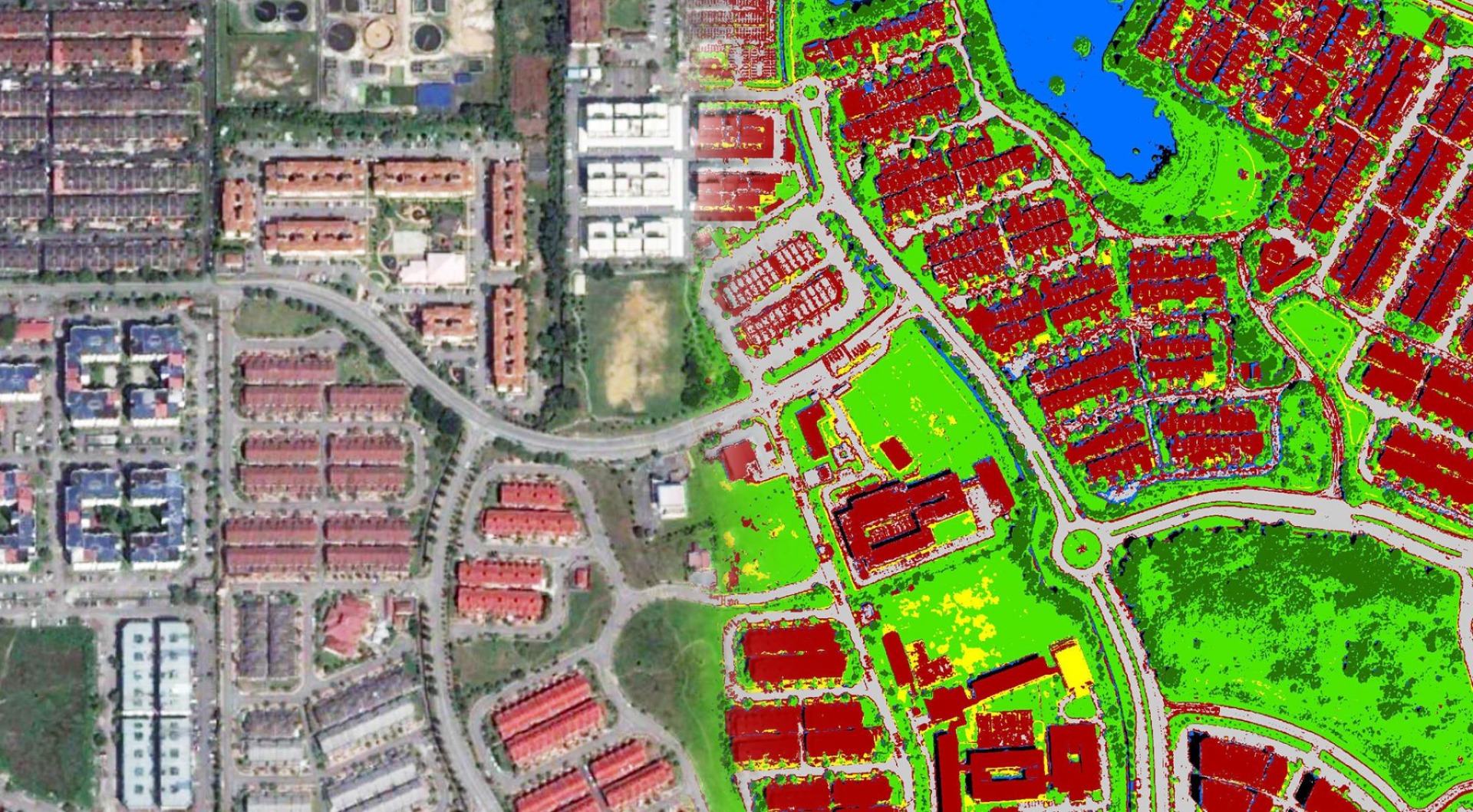
In addition to processing data, artificial intelligence can create digital models of certain events and phenomena. These models are constructed using the data from remote sensing instruments and computer vision technology.
Computer vision is a digital technology that uses AI to interpret information from image and video data. The programme uses this information to create interactable 3D models in digital space. These can represent the subject of study and provide scientists with something to work with.
Many phenomena astronomers and meteorologists study are unpredictable, and they cannot interact with them. An accurate representation of the data remote sensing instruments collect can reveal valuable information about the subject of study, even if it’s impossible to observe physically.
Scientists can use computer vision models in the organising phase of a project to ensure they use resources appropriately. Computer vision technology allows businesses to plan more thoroughly and with fewer mistakes.
In archaeology, a 3D representation of data can make analysis quicker and more accurate than conventional methods. Like astronomy, remote sensing devices can identify and measure historical artifacts without disturbing them. Intentionally or not, people often destroy historical sights and items, and they lose their original shape.
Recreating their original form using data from remote sensing and other methods can help scientists theorize what the item might have looked like before the damage. This ability to recreate a model of a site or object can give historians a significantly greater understanding of human history.
The possibilities for remote sensing become even more significant with the application of machine learning. Not only is machine learning able to manage and analyse data — it can also act on that data to manufacture more accurate models without input from a human user.
Machine learning algorithms are programmed to learn from data and apply their knowledge to solve problems. Using computer vision technology, machine learning can craft models researchers can observe and correct.
Furthermore, this technology can help plan agriculture, construction and conservation projects. Drones and satellites can capture image data of the land to create a model.
Artificial intelligence and machine learning are revolutionising remote sensing technology. These instruments can a lot to help scientists, researchers and others achieve their goals. As artificial intelligence technology advances, the applications of remote sensing tools will continue to grow.
Emily Newton is the Editor-in-Chief of Revolutionized. She is a science and technology journalist with over three years covering industry trends and research.
BBN Times connects decision makers to you. Experts in their fields, worth listening to, are the ones who write our articles. We believe these are the real commentators of the future. We quickly and accurately deliver serious information around the world. BBN Times provides its readers human expertise to find trusted answers by providing a platform and a voice to anyone willing to know more about the latest trends. Stay tuned, the revolution has begun.
Leave your comments
Post comment as a guest